Looking for design inspiration?   Browse our curated collections!

Previous PagePREV

|

1 of 5000

|

NEXTNext Page
1867 U.s. Coast Survey Chart Or Map Of Puget Sound Poster featuring the photograph 1867 U.S. Coast Survey Chart or Map of Puget Sound, Washington by Paul Fearn

Frame

Top Mat

Top Mat

Bottom Mat

Bottom Mat

Dimensions

Image:

5.00" x 8.00"

Overall:

7.00" x 10.00"


Share This Page

1867 U.S. Coast Survey Chart or Map of Puget Sound, Washington Poster

$42.56

Product Details

1867 U.S. Coast Survey Chart or Map of Puget Sound, Washington poster by Paul Fearn.   Our posters are produced on acid-free papers using archival inks to guarantee that they last a lifetime without fading or loss of color. All posters include a 1" white border around the image to allow for future framing and matting, if desired.

Design Details

This is a very uncommon U.S. Coast Survey maritime map or nautical chart of the Puget Sound, Washington Territory, dating to 1867. Covers the Sound... more

Ships Within

3 - 4 business days

You May Also Like

1878 Bien and Johnson Map of New York City Manhattan Island During the Revolutionary War Poster by Paul Fearn
1827 Finley Map of Mississippi Poster by Paul Fearn
Coast Survey Map of the Chesapeake Bay  Poster by Paul Fearn
1778 Sartine Map of Georgia North Carolina South Carolina Virginia and Maryland Poster by Paul Fearn
1777 Brion de La Tour Map of New York and New England Revolutionary War Poster by Paul Fearn
1778 Bellin Nautical Chart or Map of the World Poster by Paul Fearn
Coast Survey Chart or Map of the Chesapeake Bay Poster by Paul Fearn
1855 Colton Map of Texas Poster by Paul Fearn
1857 Colton Travellers Map of Long Island New York Poster by Paul Fearn
 A truly fascinating 1772 map of the northwestern parts of North America by Robert de Vaugondy and T Poster by Paul Fearn
1773 Bellin Map of the Cape of Good Hope Capetown South Africa Poster by Paul Fearn
1852 Levasseur Map of the Department De La Vendee France Fiefs Vendeens Wines Poster by Paul Fearn
1865 Spruner Map of Greece, Macedonia and Thrace before the Peloponnesian War Poster by Paul Fearn
1772 Vaugondy  Diderot Map of North America and the Northwest Passage Poster by Paul Fearn
1853 US Coast Survey Map of the Western Florida Panhandle Poster by Paul Fearn
1855 Colton Map of Alabama Poster by Paul Fearn
1855 Colton Map of Denmark Poster by Paul Fearn
1854 Colton Pocket Map of Ohio Michigan Wisconsin Iowa Illinois Missouri Indiana and Kentucky  Poster by Paul Fearn
1855 Spruner Map of Asia under the Mongol Empire  Poster by Paul Fearn
1780 Raynal and Bonne Map of Antilles Islands Poster by Paul Fearn
More Posters from Paul Fearn

Additional Products

1867 U.S. Coast Survey Chart or Map of Puget Sound, Washington Photograph by Paul Fearn

Photograph

1867 U.s. Coast Survey Chart Or Map Of Puget Sound, Washington Canvas Print

Canvas Print

1867 U.s. Coast Survey Chart Or Map Of Puget Sound, Washington Framed Print

Framed Print

1867 U.s. Coast Survey Chart Or Map Of Puget Sound, Washington Art Print

Art Print

1867 U.s. Coast Survey Chart Or Map Of Puget Sound, Washington Poster

Poster

1867 U.s. Coast Survey Chart Or Map Of Puget Sound, Washington Metal Print

Metal Print

1867 U.s. Coast Survey Chart Or Map Of Puget Sound, Washington Acrylic Print

Acrylic Print

1867 U.s. Coast Survey Chart Or Map Of Puget Sound, Washington Wood Print

Wood Print

1867 U.s. Coast Survey Chart Or Map Of Puget Sound, Washington Greeting Card

Greeting Card

1867 U.s. Coast Survey Chart Or Map Of Puget Sound, Washington iPhone Case

iPhone Case

1867 U.s. Coast Survey Chart Or Map Of Puget Sound, Washington Throw Pillow

Throw Pillow

1867 U.s. Coast Survey Chart Or Map Of Puget Sound, Washington Duvet Cover

Duvet Cover

1867 U.s. Coast Survey Chart Or Map Of Puget Sound, Washington Shower Curtain

Shower Curtain

1867 U.s. Coast Survey Chart Or Map Of Puget Sound, Washington Tote Bag

Tote Bag

1867 U.s. Coast Survey Chart Or Map Of Puget Sound, Washington Round Beach Towel

Round Beach Towel

1867 U.s. Coast Survey Chart Or Map Of Puget Sound, Washington Zip Pouch

Zip Pouch

1867 U.s. Coast Survey Chart Or Map Of Puget Sound, Washington Beach Towel

Beach Towel

1867 U.s. Coast Survey Chart Or Map Of Puget Sound, Washington Weekender Tote Bag

Weekender Tote Bag

1867 U.s. Coast Survey Chart Or Map Of Puget Sound, Washington Portable Battery Charger

Portable Battery Charger

1867 U.s. Coast Survey Chart Or Map Of Puget Sound, Washington Bath Towel

Bath Towel

1867 U.s. Coast Survey Chart Or Map Of Puget Sound, Washington T-Shirt

Apparel

1867 U.s. Coast Survey Chart Or Map Of Puget Sound, Washington Coffee Mug

Coffee Mug

Poster Tags

wall art posters abstract posters vintage posters map posters globe posters washington posters aged posters antique posters atlas posters cartography posters design posters exploration posters geography posters illustration posters location posters manuscript posters

Photograph Tags

photographs abstract photos vintage photos map photos globe photos washington photos aged photos antique photos atlas photos cartography photos design photos exploration photos geography photos illustration photos location photos manuscript photos

Comments (0)

There are no comments for 1867 U.S. Coast Survey Chart or Map of Puget Sound, Washington.   Click here to post the first comment.

About Posters

Posters
Cardboard Tubes

All prints ship in durable cardboard tubes.

Fine Art America is one of the largest, most-respected giclee printing companies in the world with over 40 years of experience producing museum-quality posters and prints.   All of our posters are produced on state-of-the-art, professional-grade Epson printers.

We use acid-free paper with archival inks to guarantee that your posters last a lifetime without fading or loss of color.   All posters include a 1" white border around the image to allow for future framing and matting, if desired.

Posters ship within 3 - 4 business days in durable cardboard tubes.

Poster Reviews (21229)

Average Rating (4.64 Stars):

Star Rating Full Star Rating Full Star Rating Full Star Rating Full Star Rating Empty

Elizabeth Skrivanek

April 27th, 2024

Star Rating Full Star Rating Full Star Rating Full Star Rating Full Star Rating Full
Product Review Image

I was thrilled to discover your website and find that you were offering multiple products with the image of the Filben Maestro as my grandfather, William Filben, was the inventor. I will be framing this photo for my home and anticipate ordering many other items in the near future for my large extended family

Michael Clark

April 27th, 2024

Star Rating Full Star Rating Full Star Rating Full Star Rating Full Star Rating Full
Product Review Image

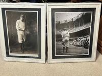
When I saw this photo of my hero, I had to obtain it because as you can see in the photo, I have Babe Ruth when he was young & strong initially with the Yankees. I want to truly thank the artist for his photo!

Michael Brauer

April 27th, 2024

Star Rating Full Star Rating Full Star Rating Full Star Rating Full Star Rating Full
Product Review Image

Terrific concert photo of Madonna back in the '80s. I hope the owner of this series featured in Life Magazine will make more available. They are stunning.

Samuel Blair

April 27th, 2024

Star Rating Full Star Rating Full Star Rating Full Star Rating Full Star Rating Full
Product Review Image

Excellent

Betty Satterfield

April 27th, 2024

Star Rating Full Star Rating Full Star Rating Full Star Rating Full Star Rating Full
Product Review Image

Very pleased, exactly what I was looking for. Thank you.

Sue Weiner

April 27th, 2024

Star Rating Full Star Rating Full Star Rating Full Star Rating Full Star Rating Full
Product Review Image

Very pleased with the whole process. Photography is beautiful and the delivery exceptional. Order to delivery was 2 days! amazing. Packaging was perfect.

Artist's Description

This is a very uncommon U.S. Coast Survey maritime map or nautical chart of the Puget Sound, Washington Territory, dating to 1867. Covers the Sound from Quimper Peninsula and Whidbey Island south as far as Olympia. The map identifies the various islands as well as safe channels and countless triangulation points throughout. Olympia, Nisqually, Steilacoom, and Seattle are named, though, aside from Olympia, most were undeveloped. Countless depth soundings appear throughout. Notes on soundings light houses, and tides appear in the lower right quadrant. Prepared under the supervision of Benjamin Pierce, Superintendent of the U.S. Coast Survey, for the 1867 Superintendent’s Report to Congress.

About Paul Fearn

Paul Fearn

My passion is Photography and Aviation or is that Aviation and Photography ! I hope you enjoy my photographs.

Shop with Confidence

Satisfaction Guarantee

Our return policy is very simple:


If you're not happy with a purchase that you made on FineArtAmerica.com, for any reason, you can return it to us within 30 days of the order date.   As soon as it arrives, we'll issue a full refund for the entire purchase price.   Please note - Fine Art America does not reimburse the outgoing or return shipping charges unless the return is due to a defect in quality.


Fine Art America sells thousands of pieces of artwork each month - all with a 100% money-back guarantee.   We take great pride in the fact that hundreds of thousands of artists have chosen Fine Art America to fulfill their orders, and we look forward to helping you select your next piece!

Delivery

All posters ship from our production facility within 3 - 4 business days of your order.


$42.56

Previous Page Next Page